Entry
Reader's guide
Entries A-Z
Subject index
Imaginative Geographies
Imaginative geographies, the images of the world and its diverse people that help a group to define its identity, are cultural representations that carry both emotional and ideological weight. Within human geography, the study of imaginative geographies takes such representations seriously; images, as shapers of people's identities and understandings of the world, also shape the world itself. Thus, imaginative geographies blur distinctions between the “real” world and the “fictional” world. That is, they are real not because imaginative geographies accurately depict the world but rather because they have reflected and reinforced people's imagination of the world in tangible and concrete ways.
Human geographers often have looked to literature as a way in which to understand how a novelist such as William Faulkner uses geographic facts of a region and converts those facts into fiction. Such an approach, although interesting, is rather different from how cultural and historical geographers during recent years have used the concept of imaginative geographies, which was first proposed by Palestinian American literary critic Edward Said. In his influential 1978 book Orientalism, Said put forth a powerful argument about the ways in which Western colonial powers came to understand non-Western cultures in general—and the “Orient” in particular—as unchanging and primitive. Crucially and related, by casting non-European peoples in such a derogatory light, colonial powers were then able to define their own identities in relation to what the “others” supposedly were not—advanced, dynamic, and sophisticated. This essential opposition between the civilized American or European and the savage native became an essential element in the struggles for domination during the colonial era, vestiges of which remain evident today. Such imaginative geographies, Said posited, clearly are linked to political–economic power and to the asymmetrical social relations that are at the heart of racism.
Imaginative geographies are based, to a very large degree, on the circulation of textual and visual materials that give substance and meaning to such images. Intelligence reports, maps, and popular travel writing became extremely influential means by which people learned about distant places and people. During the 19th century, readers pored over the travel accounts of famous writers, such as Florence Nightingale and Gustave Flaubert, to discover the ruins of Egypt. Imperial Britain employed sophisticated mapping techniques not only to create the spatial image of its Indian empire but also to legitimate its colonialist activities as triumphs of rational science bringing “civilization” to allegedly irrational and despotic Indians. And from the mid-19th century through the early 20th century—during the “age of empire”—photographs played a decisive role in constructing imaginative geographies. With its heightened sense of realism, its ability to produce a feeling of “being there,” and its widespread dissemination, the photograph became an active instrument in producing geographic knowledge of distant places, including those that came under colonial rule (Figure 1). Travel writing, maps, and photography remain important vehicles for producing and consuming imaginative geographies, but they have been supplemented by newer media such as television, movies, popular magazines, advertising, and mass tourism.
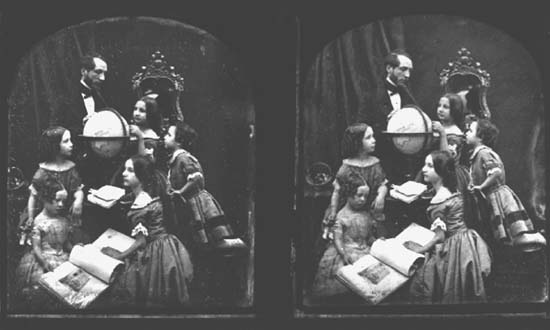
Figure 1 “The Geography Lesson” Showing the Merging of Maps, Literature, Art, and Photography in the Construction of Imaginative Geographies
...
- Cartography/Geographic Information Systems
- Agent-Based Modeling
- Automated Geography
- Cartogram
- Cartography
- Cellular Automata
- Computational Models of Space
- Digital Earth
- Ecological Fallacy
- Fractal
- Geodemographics
- Geoslavery
- GIS
- GPS
- Humanistic GIScience
- Information Ecology
- Limits of Computation
- Location-Based Services
- Multicriteria Analysis
- Neural Computing
- Ontology
- Overlay
- Social Informatics
- Spatial Autocorrelation
- Spatial Dependence
- Spatial Heterogeneity
- Spatially Integrated Social Science
- Tessellation
- Time, Representation of
- Uncertainty
- Economic Geography
- Agglomeration Economies
- Agriculture, Industrialized
- Agriculture, Preindustrial
- Agro-Food System
- Applied Geography
- Capital
- Carrying Capacity
- Cartels
- Census
- Census Tracts
- Circuits of Capital
- Class
- Class War
- Colonialism
- Commodity
- Comparative Advantage
- Competitive Advantage
- Conservation
- Consumption, Geography and
- Core–Periphery Models
- Crisis
- Debt and Debt Crisis
- Deindustrialization
- Dependency Theory
- Developing World
- Development Theory
- Division of Labor
- Economic Geography
- Economies of Scale
- Economies of Scope
- Export Processing Zones
- Externalities
- Factors of Production
- Flexible Production
- Fordism
- Globalization
- Gravity Model
- Gross Domestic Product
- Growth Pole
- High Technology
- Import Substitution
- Incubator
- Industrial Districts
- Industrial Revolution
- Informal Economy
- Infrastructure
- Innovation, Geography of
- Input–Output Models
- Labor Theory of Value
- Labor, Geography of
- Location Theory
- Mode of Production
- Modernization Theory
- Money, Geography of
- Neocolonialism
- Neoliberalism
- New International Division of Labor
- Newly Industrializing Countries
- Postindustrial Society
- Producer Services
- Product Cycle
- Profit
- Resource
- Restructuring
- Rural Development
- Rustbelt
- Structural Adjustment
- Sustainable Development
- Telecommunications, Geography and
- Terms of Trade
- Trade
- Transnational Corporations
- Transportation Geography
- Underdevelopment
- Uneven Development
- World Economy
- Geographic Theory and History
- Anthropogeography
- Berkeley School
- Chorology
- Discourse
- Ethnocentrism
- Eurocentrism
- Existentialism
- Exploration, Geography and
- History of Geography
- Human Agency
- Humanistic Geography
- Ideology
- Idiographic
- Imaginative Geographies
- Interviewing
- Locality
- Logical Positivism
- Marxism, Geography and
- Model
- Nomothetic
- Orientalism
- Paradigm
- Participant Observation
- Phenomenology
- Place
- Postcolonialism
- Postmodernism
- Poststructuralism
- Qualitative Research
- Quantitative Methods
- Quantitative Revolution
- Queer Theory
- Radical Geography
- Realism
- Regional Geography
- Scale
- Situated Knowledge
- Spaces of Representation
- Spatial Analysis
- Structuralism
- Structuration Theory
- Subaltern Studies
- Subject and Subjectivity
- Theory
- Tobler's First Law of Geography
- Political Geography
- Anticolonialism
- Boundaries
- Bureaucracy
- Civil Society
- Communism
- Critical Geopolitics
- Decolonization
- Democracy
- Electoral Geography
- Environmental Determinism
- Environmental Justice
- Geopolitics
- Gerrymandering
- Hegemony
- Imperialism
- Institutions
- Justice, Geography of
- Law, Geography of
- Local State
- Nation-State
- Nationalism
- Political Ecology
- Political Geography
- Power
- Redistricting
- Resistance
- Social Movement
- Socialism
- Sovereignty
- State
- World Systems Theory
- Social/Cultural Geography
- AIDS
- Animals
- Art, Geography and
- Behavioral Geography
- Body, Geography of
- Children, Geography of
- Communications, Geography of
- Crime, Geography of
- Critical Human Geography
- Cultural Ecology
- Cultural Geography
- Cultural Landscape
- Cultural Turn
- Culture
- Culture Hearth
- Cyberspace
- Demographic Transition
- Diaspora
- Diffusion
- Disability, Geography of
- Domestic Sphere
- Emotions, Geography and
- Empiricism
- Enlightenment, The
- Environmental Perception
- Epistemology
- Ethics, Geography and
- Ethnicity
- Femininity
- Feminisms
- Feminist Geographies
- Feminist Methodologies
- Fertility Rates
- Fieldwork
- Film, Geography and
- Food, Geography of
- Gays, Geography and/of
- Gender and Geography
- Geography Education
- Health and Healthcare, Geography of
- Heterosexism
- Historic Preservation
- Historical Geography
- Home
- Homophobia
- Hunger and Famine, Geography of
- Identity, Geography and
- Languages, Geography of
- Lesbians, Geography of/and
- Literature, Geography and
- Malthusianism
- Masculinities
- Medical Geography
- Mental Maps
- Migration
- Mobility
- Modernity
- Mortality Rates
- Music and Sound, Geography of
- Natural Growth Rate
- Nature and Culture
- Nomadism
- Other/Otherness
- Peasants/Peasantry
- Photography, Geography and
- Place Names
- Popular Culture, Geography and
- Population Pyramid
- Population, Geography and
- Poverty
- Production of Space
- Psychoanalysis, Geography and
- Race and Racism
- Religion, Geography of
- Rural Geography
- Segregation
- Sense of Place
- Sequent Occupance
- Sexuality, Geography of
- Social Geography
- Social Justice
- Space, Human Geography and
- Spatial Inequality
- Spatiality
- Sport, Geography of
- Symbols and Symbolism
- Text and Textuality
- Time Geography
- Time–Space Compression
- Topophilia
- Tourism, Geography of
- Travel Writing, Geography and
- Virtual Geographies
- Vision
- Whiteness
- Wilderness
- Writing
- Urban Geography
- Built Environment
- Central Business District
- Chicago School
- City Government
- Cognitive Models of Space
- Derelict Zones
- Edge Cities
- Exurbs
- Gated Community
- Gentrification
- Ghetto
- Global Cities
- Growth Machine
- Homelessness
- Housing and Housing Markets
- HUD
- Invasion–Succession
- Locally Unwanted Land Uses
- Neighborhood
- Neighborhood Change
- New Urbanism
- NIMBY
- Open Space
- Public Space
- Rent Gap
- Rural–Urban Continuum
- Squatter Settlement
- Suburbs
- Sunbelt
- Urban and Regional Planning
- Urban Ecology
- Urban Entrepreneurialism
- Urban Fringe
- Urban Geography
- Urban Managerialism
- Urban Social Movements
- Urban Spatial Structure
- Urban Sprawl
- Urban Underclass
- Urbanization
- Zoning
- Loading...
Get a 30 day FREE TRIAL
-
 Watch videos from a variety of sources bringing classroom topics to life
 -
Read modern, diverse business cases
-
Explore hundreds of books and reference titles

Read next

More like this
Sage Recommends
We found other relevant content for you on other Sage platforms.
Have you created a personal profile? Login or create a profile so that you can save clips, playlists and searches